LEICA GEOSYSTEMS
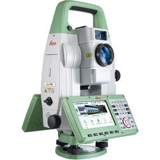
TOTAL STATIONS - LEICA TS16Providing accurate and efficient measurements, Total Stations are equipped with unsurpassed angle, distance and reflectorless technology. With a powerful suite of on board programs and multiple sensor and accuracy settings, the TS16 provides ultimate reliability both on and off site.
|
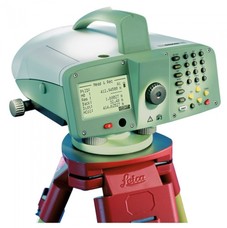
DIGITAL LEVELSFor all technical leveling tasks, the Leica DNA10 Digital Auto Level with 24x magnification features high accuracy, internal memory, onboard surveying programs and an alphanumeric keyboard. With a working range of up to 360 feet, this optical instrument also has a large, backlit LCD screen that presents accurate height, distance and angle measurements.
|
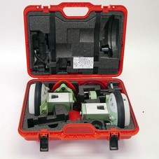
GS15 BASE STATION & ROVERThe Leica Viva GS15 is an industry leading all in the box RTK solution. Tough, robust and accurate the GS15 is Leica’s top of the range GNSS instrument, tracking both GPS and GLONASS satellites.
|
UNMANNED AERIAL VEHICLES (UAV)

DJI MATRICE 210 RTK |
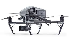
DJI INSPIRE 2 |

DJI MAVIC PRO |
Platinum Surveys uses DJI UAV's providing fast, safe and cost effective mapping services across all terrain. Applications include digital elevations and contour mapping, Lidar, Photogrammetry and volumetric services, industry inspections (thermal, infra-red, multi spectrum, high resolution imagery), professional videos, still images and 3d photography services. We provide post production editing services for professional videography and photographic presentations.
OPERATING SOFTWARE

12d MODEL12d Model is a powerful terrain modelling, surveying and civil engineering software package. It allows quick and high quality production in a wide variety of projects.
|
LISCADLISCAD Surveying & Engineering Field & office Software is a purpose made software for the Engineer and Surveyor. Data from virtually any surveying instrument can be imported and turned into finished plan
|
EDM FOR SURVEYORSEDM is a Windows program specifically created for surveyors to organise projects and ensure crucial information is centrally stored and retrieved efficiently. It is 100% designed and written by surveyors for surveyors.
|
